
From space rovers to hunger maps: How AI is reshaping humanitarian aid
From Space Rovers to Hunger Maps: How AI is Reshaping Humanitarian Aid From space rovers to hunger maps - Humanitarian efforts in high-risk environments, such

From Space Rovers to Hunger Maps: How AI is Reshaping Humanitarian Aid
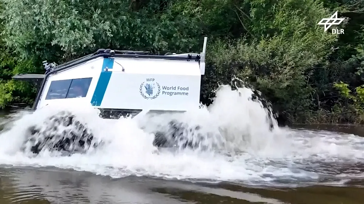
Poinews.com – Humanitarian efforts in high-risk environments, such as conflict zones, minefields, and flood-prone regions, often face life-threatening dangers for workers. A groundbreaking shift is now underway, as technology originally designed for planetary exploration is being repurposed to enhance aid operations. Project AHEAD, a joint initiative between the World Food Programme, Germany’s aerospace research centre DLR, the Red Cross, and tech partners, is creating remote-controlled vehicles to transport supplies through areas deemed too perilous for standard delivery methods.
Robotic Solutions for High-Danger Zones
At a DLR testing facility in Germany, a SHERP all-terrain vehicle demonstrated its ability to navigate open water and rough terrain. Equipped with sensors to analyze the ground ahead, the vehicle can operate without a human driver, controlled remotely by an operator. This innovation leverages DLR’s expertise in developing autonomous and remote-controlled rovers, such as the MMX model designed for exploring Phobos, Mars’s moon.
While physical delivery systems are evolving, AI’s influence extends to data-driven insights. The World Food Programme’s HungerMap Live platform utilizes machine learning and real-time data to monitor food insecurity in over 95 nations. It integrates factors like conflict, weather patterns, climate threats, and economic indicators to detect early signs of hunger crises. As Bernhard Kowatsch, director of the WFP’s Global Accelerator and Ventures division, explained:
“Everybody can check it out, HungerMap Live, on the internet. You can get real-time data, and right now we’re even looking into forecasting food security 90 days into the future.”
Maps as Critical Tools in Crisis
Accurate geographical data remains essential for effective humanitarian responses. Without clear maps of roads, buildings, and population hubs, aid teams may struggle to determine evacuation routes, shelter locations, or supply distribution points. During a recent earthquake in northern Venezuela, limited data hindered assessments of damage, delaying aid. The Humanitarian OpenStreetMap Team deployed machine learning to analyze satellite images, identifying damaged structures. Volunteers used the MapSwipe app to mark affected zones, enabling rapid response within days.
Leen D’hondt, director of technology and data at the Humanitarian OpenStreetMap Team, noted:
“Within four days after the earthquake, we were able to mobilise more than 600 volunteers swiping left and right on the mobile app to indicate: yes, this building area is damaged; no, this building area is not damaged.”
She emphasized that AI provides approximate data, which is often sufficient for immediate action, even if it lacks the precision of manual mapping. “Manual mapping still provides the best quality. However, sometimes speed is more important,” she added.
Global Adoption and Future Prospects
Despite progress, AI systems are not yet universally integrated into emergency protocols. Monique Kuglitsch, innovation manager at the Fraunhofer Heinrich Hertz Institute, stated:
“Right now, there aren’t really systems integrated into these emergency protocols in most countries.”
Exceptions exist, such as India’s AI-based early-warning system and Europe’s operational AI forecasting tool from the European Centre for Medium-Range Weather Forecasts. In many regions, however, these technologies remain in experimental phases.