Spain braces for heatwave: up to 44ºC before Tuesday ends
44ºC Spain braces for heatwave - The Spanish State Meteorological Agency has issued a warning for the second heatwave of the 2026 summer, set to begin this

Spain Anticipates Severe Heatwave: Temperatures Could Hit 44ºC
Poinews.com – The Spanish State Meteorological Agency has issued a warning for the second heatwave of the 2026 summer, set to begin this Sunday and persist through at least Tuesday. This weather event is expected to bring scorching temperatures, with some regions anticipating highs as high as 42ºC in the south-western river valleys of the mainland.
Temperature Projections and Regional Variations
According to AEMET’s data, the Minho valley will experience temperatures of 38–40ºC on Monday, while the interior of A Coruña is forecast to reach 37–39ºC. The south-western quadrant will see widespread temperatures between 39–41ºC, with some areas potentially hitting 42ºC. On the southern plateau, the Ebro valley, and north-eastern depressions, the mercury is expected to stay within 37–40ºC.
“The peak of the episode will not arrive on Tuesday,” states AEMET, noting that Monday, the 6th, will be the most intense day, with further temperature rises in the eastern Cantabrian area, which will also affect the Ebro valley, northern plateau, and eastern mainland regions.
Impact on Wildfires and Coastal Areas
Monday’s extreme heat could exacerbate the Bisbal d’Empordá wildfire, with temperatures possibly reaching 44ºC by Tuesday. Meanwhile, western Galicia will begin to see a cooling effect as maritime air influences the region, leading to lower coastal temperatures.
Uncertainty on Wednesday and Regional Alerts
Wednesday’s forecast remains uncertain due to the potential influence of a “dana,” an isolated upper-level depression. The most likely scenario suggests temperatures will remain above 39–40ºC in the south-west, southern plateau, Ebro valley, and inland areas of the south-east, before declining from Thursday onwards.
Heatwave Alerts and Coastal Wind Warnings
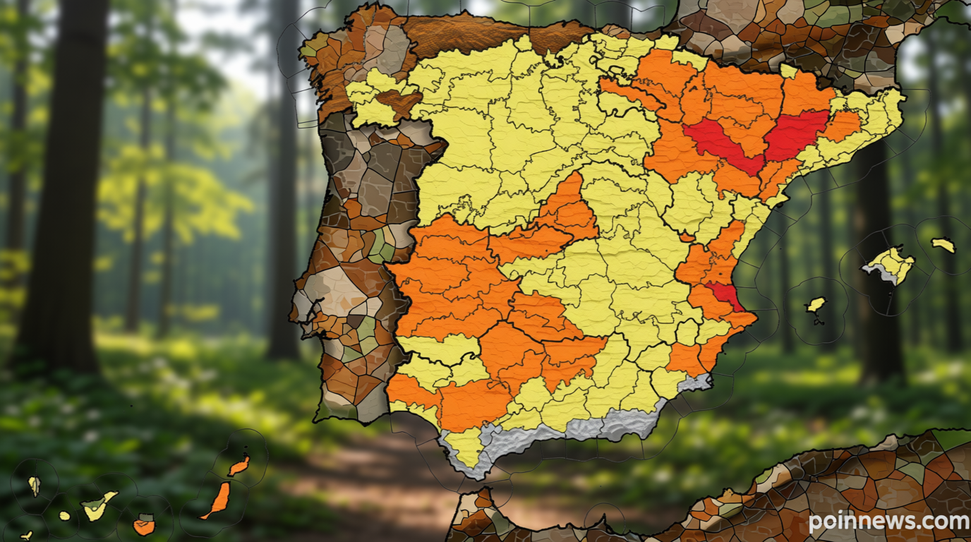
On Saturday, AEMET activated an orange alert for Seville, Huelva, and Jaén, with a yellow alert for Cádiz and Granada. Temperatures in these districts are likely to peak at 40ºC. Almería, however, is not currently under these warnings. Additionally, the Cádiz coastline faces a yellow alert for Levante wind gusts, requiring vigilance in the Strait of Gibraltar.
Broader Risk Zones and Dynamic Updates
AEMET’s alert map highlights the south-western mainland, Guadiana and Guadalquivir valleys, Ebro valley, and north-eastern depressions as areas with the highest risk. The phenomenon also extends to inland Galicia, the southern plateau, eastern Cantabrian coast, and the Balearic Islands, where Mallorca is expected to see temperatures between 36ºC and 38ºC. AEMET’s map is updated dynamically as models evolve, though confirmed alerts include orange status for the south-western mainland, Ebro valley, and eastern Canaries, with a wider yellow alert surrounding these regions.
Heatwave Classification and Nighttime Risks
AEMET defines a heatwave as an event where temperatures exceed the 95th percentile by a significant margin, lasting at least three days and impacting over 10% of the territory. Current forecasts suggest these conditions are likely to be met. Beyond daytime extremes, minimum temperatures are projected to range from 20–26ºC, with nighttime peaks of 27–28ºC, creating tropical nights across much of the country.
Wildfire Preparedness and Public Health Concerns
The risk of wildfires remains heightened, with the INFOCA plan active at a pre-alert level in Andalusia. The Canary Islands government has also declared a forest-fire risk alert for Gran Canaria and Tenerife, following a prolonged heat spell. Public health specialists emphasize that the persistent high temperatures, even during nighttime, are as critical as daytime peaks in assessing overall risk.